logo logo

Business

All-in-One Services for Digital Construction

R&D

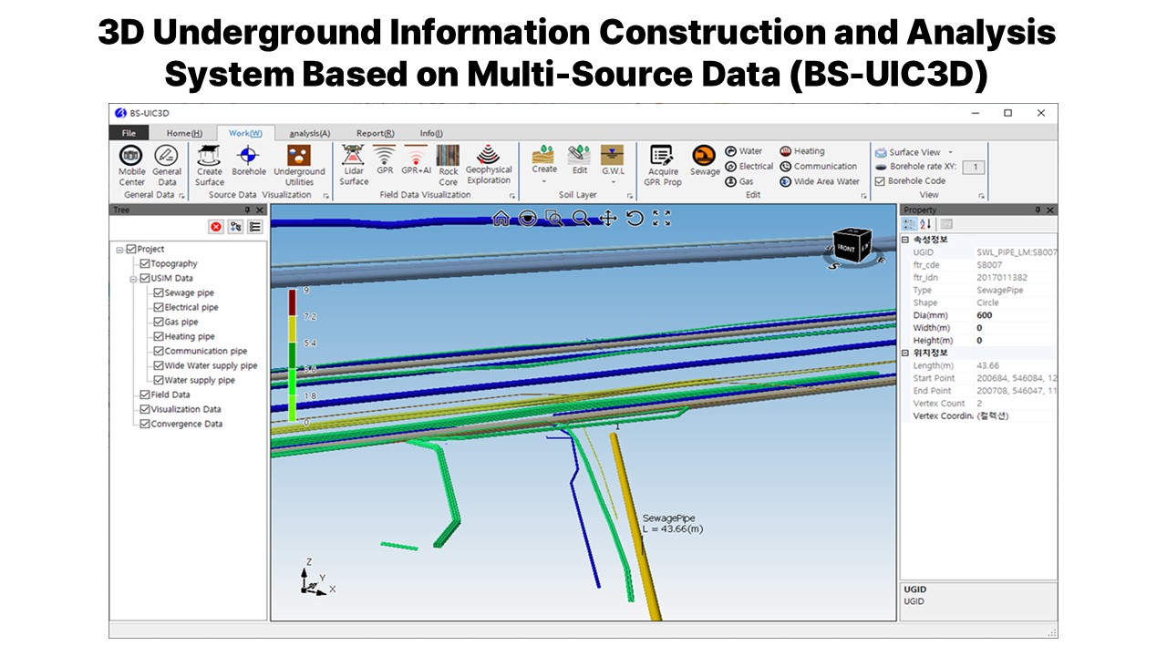
Development of 3D Underground Information Generation and Analysis Technology Based on Convergence Datum (2020 ~ 2023)

PROJECT OUTLINE

Client
Ministry of Land, Infrastructure and Transport (MOLIT)
Lead Research Organization
Korea Institute of Civil Engineering and Building Technology (KICT)
Stage
Joint Research Organization
Period
Apr. 28, 2020 – Dec. 31, 2023

PROJECT FEATURES

  •  Development of an accuracy enhancement algorithm through the fusion of multi-source data—including real-time GPR and high-precision DEM data acquired on-site, data from the underground spatial information platform (e.g., borehole data), and geophysical survey data (e.g., seismic surveys)—and implementation as a software solution.
  • Addition of 3D visualization capabilities for underground spatial information (e.g., integrated underground maps and subsurface utilities) to support excavation activities → BS-UIC3D